
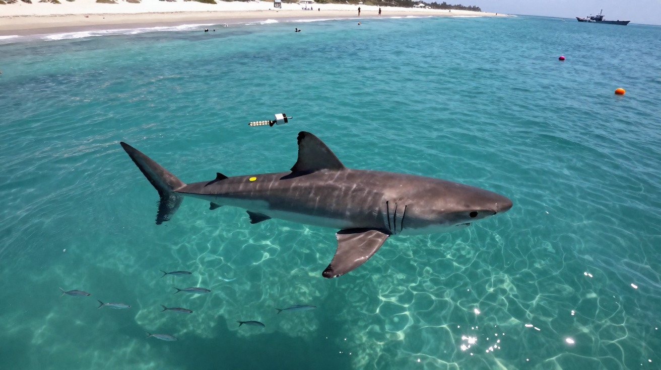
At dawn, the first boats still leave the ports along the Atlantic coast, amid lobster pots, nets and the reassuring rhythm of routine. Then an alert reaches the scientific community: a great white shark measuring about four metres, fitted with a tag, is gradually moving north-east. Its location does not appear as a fixed dot on a map. Instead, it is recorded intermittently, according to its dives, returns to the surface and satellite transmissions. For the teams monitoring the animal, every signal is a small success. For the public, the image is inevitably striking: a legendary predator, so often imagined and misunderstood, is travelling a few hundred kilometres from Atlantic beaches. Yet beyond the thrill, the data primarily tell the story of a patient, entirely logical journey. They also contain a few surprises.
A discreet route, far from the image of a shark heading straight for the beach
On biologists’ screens, its route initially looks like a broken line, and at times a frustrating one. The shark does not send its position every minute: its tag transmits data when it comes sufficiently close to the surface, after which satellites relay it to laboratories. In recent weeks, the received locations have traced a northward movement into temperate Atlantic waters, with offshore detours rather than a direct approach to the coastline. A great white shark does not follow a marine motorway. It uses currents, drops into colder layers, sometimes rises at night, then moves on again without warning. This gradual progress is intriguing because it reminds us that the sea has its own routes, invisible from shore.
The monitored individual is thought to be almost four metres long: an impressive size, but one consistent with an adult or large sub-adult. An animal of this build can cover several dozen kilometres in a day while remaining completely out of human sight. Satellite-tracking records show that some great white sharks alternate between long periods in open water and trips closer to the continental shelf, where food is plentiful. In this particular case, the readings mainly indicate movement between deeper areas and waters rich in pelagic fish. Its size is not the detail that matters most. Its consistency is: the animal appears to know this stretch of ocean better than we might assume.
Scientists do not simply examine latitude and longitude. They compare locations with water temperature, dive depth, currents and, where the tag permits it, movement acceleration. A journey towards the Atlantic coast may indicate a search for prey, a breeding period or a seasonal strategy that remains poorly understood. Great white sharks can dive to considerable depths before returning to much warmer waters. This adaptability explains their presence in regions where they are not always expected. The most useful signal is not the one that causes alarm; it is the one that helps us understand.
What satellite tags truly reveal about great white shark travel habits
To monitor a great white shark, teams generally attach a tag to the dorsal fin or use a device that records data before detaching. It is fitted during a tightly controlled operation from a boat, with one simple aim: keeping handling time to an absolute minimum. Once the shark is released, a sometimes lengthy wait begins. The information received is then checked, cleaned and compared with oceanographic records. This approach requires patience. Let us be honest: hardly anyone does this every day, even among marine-life enthusiasts. Raw maps can be misleading, because a missing signal does not mean the shark has vanished.
A common mistake is to assume that a location transmitted offshore means an imminent arrival in a swimming area. A plotted position may be several hours old, or occasionally older, depending on transmission quality. In that time, the animal may have changed course, dived several hundred metres or drifted with a current. For holidaymakers, the most sensible response remains straightforward: follow local guidance, avoid swimming alone far from the shore, and do not try to watch the animal from a private boat. Curiosity is natural, but it should not turn scientific monitoring into a hunt for spectacle.
Researchers also stress an often-overlooked distinction: the presence of a great white shark in the Atlantic is not enough to indicate an immediate danger to swimmers. Human interactions remain extremely rare, while the animal generally favours areas where prey can be reached without unnecessary disturbance. A biologist specialising in shark tracking often sums up this caution as follows:
“A tag does not tell us a shark’s intentions. It tells us about its movements, and that is already immense.”
- Check information issued by local maritime authorities.
- Avoid areas where shoals of fish or marine mammals have been reported.
- Never attempt to approach, feed or follow a wild marine animal.
A spectacular visitor highlighting the Atlantic’s fragility
Watching the track of a great white shark move towards the Atlantic coast forces us to see the ocean differently. From the beach, the horizon seems calm and almost motionless. Beneath the surface, migrations intersect, temperatures shift and species gradually alter their habits. The route of this four-metre shark alone does not prove a major upheaval. Nevertheless, it provides a rare view of a world changing at a pace that can be hard to measure from land. Tags turn a mythical creature into a real animal: mobile, vulnerable and reliant on specific resources.
The sighting also raises a very everyday question: what do we do with our fascination? We can share a map, marvel at the distance travelled and picture a fin in dark water. However, the more lasting value lies elsewhere: in safeguarding the ecosystems on which this traveller depends. Reducing bycatch, protecting the fish it eats and supporting tracking programmes give this curiosity a practical purpose. The shark is not an intruder in the ocean: we are its visitors. Its route, still incomplete on monitoring screens, may well become one of the season’s most closely followed marine stories.
| Key point | Detail | Benefit for the reader |
|---|---|---|
| A route tracked by satellite | The tag sends intermittent locations when the shark comes back to the surface. | Understand why a tracking map never displays a perfectly real-time journey. |
| A four-metre shark | Its size is spectacular, but its behaviour remains driven by prey, currents and temperature. | Avoid alarmist interpretations based on its presence alone. |
| A responsible approach | Local guidance and keeping a distance from wild animals remain the best course of action. | Make use of the information without putting people or the animal at risk. |






Comments
No comments yet. Be the first to comment!
Leave a Comment